Light Detection and Ranging, also known as LiDAR, is a remote detection system. LiDAR uses light in the form of laser pulses to determine variable distances by measuring the time it takes the pulses to reflect off objects or surfaces and return to its receiver. Unlike RADAR (Radio Detection and Ranging), LiDAR uses light instead of radio waves to generate images of scanned surfaces, bodies of water, and the atmosphere.
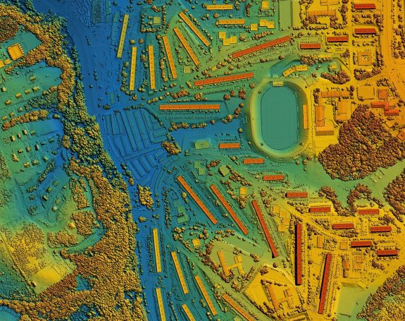
LiDAR scan of an urbanized area
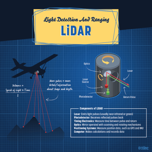
Detecting and Calculating Distances with LiDAR Systems
- The distance between the LiDAR and the target is equal to one-half of the time between sending the laser pulse and receiving the reflection and multiplied by the speed of light: Distance (d) = tc/2 - Speed of Light Multiplied by Time (t).
- Ground elevation is determined by taking the aircraft’s altitude calculated by the GPS receiver, then subtracting the distance from the light traveling to the ground.
LiDAR System Components and Functionality
The components of a LiDAR system consist of a laser and optics working as a mirror with scanning and rotating mechanisms to reflect the laser from its source. Also, a photodetector that is the receiver for the return pulse and timing electronics to measure the time between the pulse and return. There is a positioning system to measure the altitude and position of the application from the GPS and IMU, and a computer to make calculations and record data.
LiDAR uses green or near-infrared light to scan an area downwards or side to side from an application and flashes up to 400,000 laser pulses per second.
An example of an application utilizing LiDAR systems is airplanes and helicopters. As a LiDAR system sends laser pulses off the optics, the aircraft’s position and orientation are monitored. Once the optics receive the return laser back to the photodetector, the internal GPS determines the airplane’s position over the ground. An inertial measurement unit (IMU) is fitted with three gyroscopes to determine the distance. The IMU tracks the tilt of the aircraft. LiDAR systems are typically accurate to in 15 cm (6 inches) in vertical elevation.
The laser pulse is reflected and detected by a receiver in single or multiple returns. A single laser pulse return reflects from uniform surfaces like the ground. Lasers reflected from multiple laser pulse returns are received from pulses navigating through treetops or other obstructions. The constant laser pulses ‘describe’ the shape of trees and the density of heavily forested areas and eventually make surface contact.
Additional LiDAR applications include ground-based systems that transmit laser pulses less frequently than aircraft and satellites in space-based systems that cover large surface areas.
Types of LiDAR
Examples of LiDAR Types: Topographic and Bathymetric:
- Topographic LiDAR uses an infrared laser to map and study ground characteristics. This helps ecologists understand rainforest landforms and conservationists research forest vegetation.
- Bathymetric LiDAR uses two lasers to measure the shallow depths in bodies of water. One laser transmits near-infrared wavelengths that reflect off a water’s surface. Other lasers use optical wavelengths that reflect off the ocean floor. Oceanographers use this system to study the physical elements of oceans and detect possible shipwrecks.
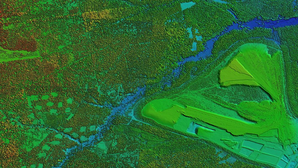 A Topographic LiDAR scan of a heavily forested area
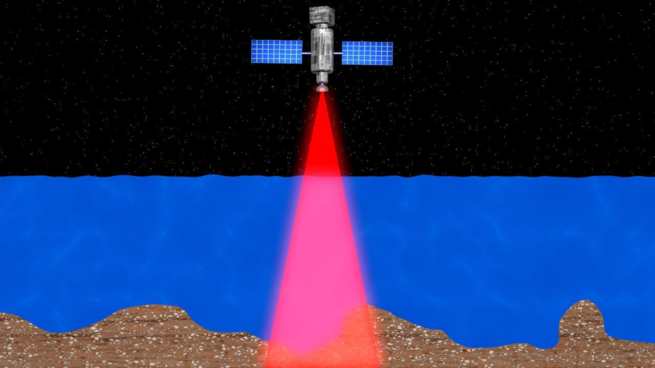 A Bathymetric LiDAR scan of water conducted by a satellite
The History of LiDAR systems
Attempts to measure distance by light beams began with searchlights in the 1930s to study the structure of the atmosphere and later light pulses were used to determine the heights of clouds. According to the American Physical Society, the first working laser was built in 1960 by Theodore H. Maiman at the Hughes Research Laboratories in California.
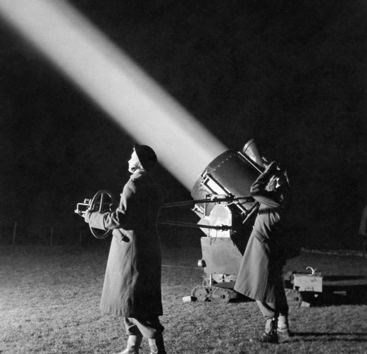
Searchlights were an early application that used light for measuring large distances
LiDAR-like systems were first introduced in 1961 to track satellites under the guidance of Malcolm Stitch, manager of the Laser Development program in the Radar and Missile Electronics Laboratory at Hughes Aircraft Company.
The first LiDAR systems used sensor and data acquisition technology combined with laser-focused imaging to calculate distances by measuring the time it takes a signal to return to a receiver.
Additional examples of early LiDAR uses are meteorologists detecting clouds and pollution and astronauts aboard the Apollo 15 mission using a laser altimeter to map the moon's surface. Once GPS equipment became commercially available in the late 1980s, LiDAR data became what it is today.
The Future of LiDAR
LiDAR systems are utilized every day in mobile devices, self-driving cars, drones, and space exploration applications. Advancements in technology have even led to LiDAR systems being available in 3-D printed objects like Project Lighthouse. Hobbyists may use LiDAR technology for their robotic needs in order to map and calculate short distances for drone applications.
Soon LiDAR systems will integrate semiconductor technologies that move away from discrete and mechanical components. Innovation pushes LiDAR technology further by improving environmental safety and awareness while making discoveries that benefit human life.
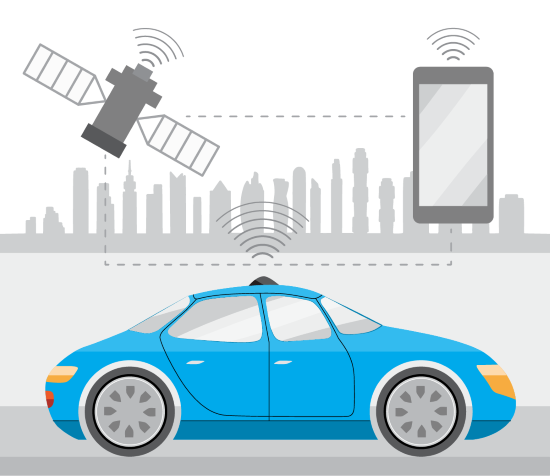
Satellites, Mobile and Automotive LiDAR Applications
Looking for LiDAR-type components?
If you have any questions, call TTI's customer support at (877) 645-4884
Search all TTI Optical Sensor Products